Volcano Project Information
Eyjafjallajökull means Icelandic for "island-mountain glacier named after one of the smaller ice caps of Iceland. It is situated to the north of skögar and to the west of Mýrdalsjökull. The ice cap covers the caldera of a volcano with a summit elevation of 1,666 meters (5,466 ft) The volcano has erupted relatively frequently since the last glacial period. Recently it erupted last year and it sent a plume of ash towards the United Kingdom. I collected some of the ash from the volcano which had been deposited on our silver Seat-Alhambra car in North Kessock.
The ice cap covers an area of about 100 square kilometers (39 sq mi), feeding many outlet glaciers. The main outlet glaciers are to the north; Gígjökull, flowing into Lónið, and Steinholtsjökull, flowing into Steinholtslón. The glacier is the 6th largest in Iceland. In 1967 there was a massive landslide on the Steinholtsjökull glacial tongue. On January 15, 1967 at 13.47.55 there was an explosion on the glacier. It can be timed because the earthquake meters in Kirkjubæjarklaustur monitored the movement. When about 15 million cubic meters of material hit the glacier a massive amount of air, ice, and water began to move from under the glacier out into the lagoon at the foot of the glacier.
The mountain, a stratovolcano, stands 1,651 metres (5,417 ft) at it highest point, and has crater 3–4 kilometres (1.9–2.5 mi) in diameter, open to the north. The crater rim has three main peaks, being (clockwise from the north-east) Guðnasteinn, 1,500 metres (4,900 ft) (approx), Hámundur, 1,651 metres (5,417 ft) and Goðasteinn, 1,497 metres (4,911 ft). The south face of the mountain was once part of Iceland's Atlantic coastline, from which, over thousands of years, the sea has retreated some 5 kilometres (3.1 mi). The former coastline now consists of sheer cliffs with many waterfalls, of which the best known is Skógafoss. In strong winds, the water of the smaller falls can even be blown up the mountain. The area between the mountain and the present coast is a relatively flat strand, 2 to 5 km wide, called Eyjafjöll.
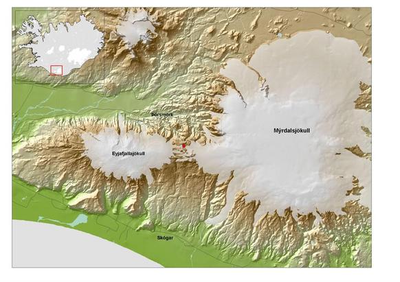
Eyjafjallajökul is located in South Iceland.
When it erupted it sent a cloud of ash towards the UK in April 2010. The pictures below show microscopic views of the ash Yan collected. Yans sample was analysed using a polarising microscope which revealed characteristic features of the minerals olivine and pyroxene. These minerals are typical of icelandic type volcanoes. They erupt lava that has come from the splitting apart of the oceanic crust along fracture zones known as Ocean Rifts. In Iceland their is also a plume of molten material situated on the rift which has greatly increased the amount of molten rock supplying the erupting volcanoes.
When it erupted it sent a cloud of ash towards the UK in April 2010. The pictures below show microscopic views of the ash Yan collected. Yans sample was analysed using a polarising microscope which revealed characteristic features of the minerals olivine and pyroxene. These minerals are typical of icelandic type volcanoes. They erupt lava that has come from the splitting apart of the oceanic crust along fracture zones known as Ocean Rifts. In Iceland their is also a plume of molten material situated on the rift which has greatly increased the amount of molten rock supplying the erupting volcanoes.
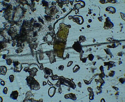
Volcanic ash crystals from Eyjafjallajökullor
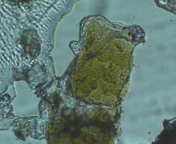
close up of olivine crystal
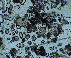
Fast cooled droplets of molten rock forming wavy edges on crystals of olivine which make up the ash sample
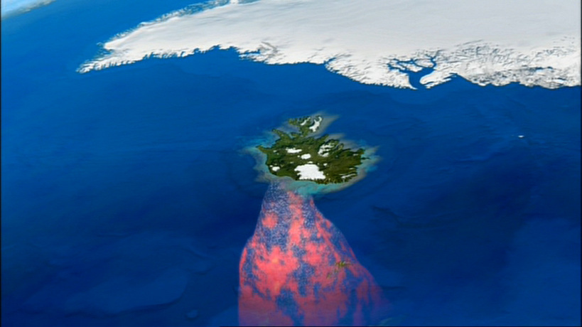
The Icelandic Plume
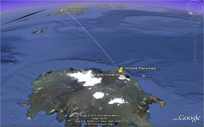
Eyjafjallajökull and its more dangerous sister volcano, Katla are a continuing volcanic hazard. The level of activity has to be carefully monitored by scientists to try and predict the next eruption. The distance from these volcanoes to Scotland is only about 600 miles !
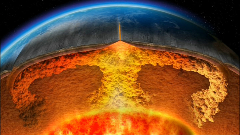
Iceland sits on top of the Mid Atlantic Rift Zone
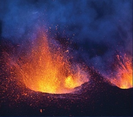
Eyjafjallajökull erupting.
